 copyright: OBK
Flood Prevention at Agger and Wupper (ÜVAW)
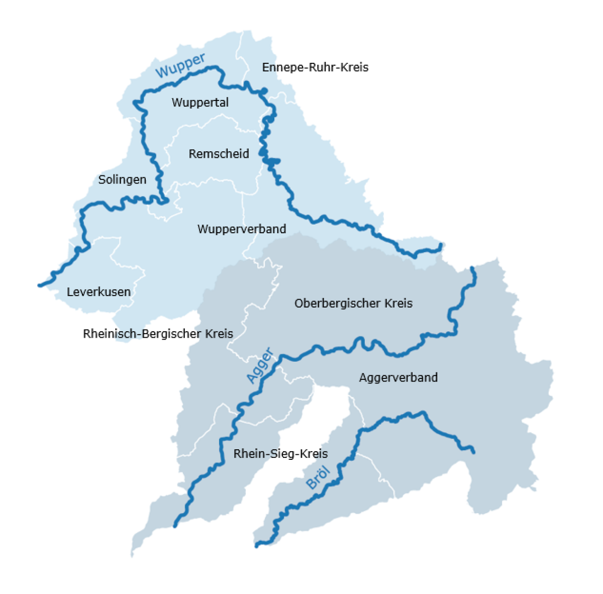
Cooperation Partners:
Aggerverband
Ennepe-Ruhr-Kreis
Oberbergischer Kreis
Rhein-Sieg-Kreis
Rheinisch-Bergischer Kreis
City of Leverkusen
City of Remscheid
City of Solingen
City of Wuppertal
Wupperverband
This page was translated from German using artificial intelligence. The translation may contain errors or inaccuracies. In case of doubt, the German original version prevails.
Floods and Heavy Rain in the Bergisches Land
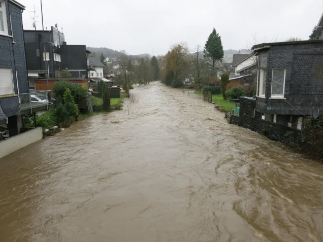
The Bergisches Land faces significant challenges due to the expected increase in heavy rain and flood events.
The region is characterized by a topography with many slopes, numerous rivers and streams, as well as relatively dense population and high precipitation amounts.
The hilly landscape means that rainwater, if not retained or absorbed, flows into water bodies at high speed, which can quickly cause them to overflow.
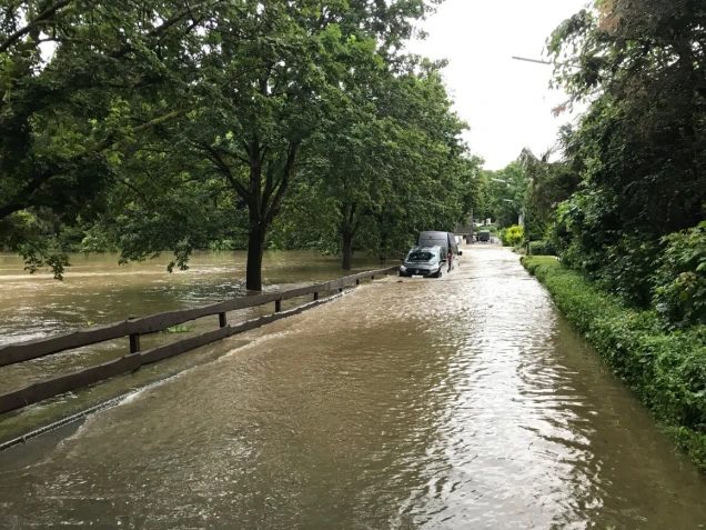
The high population density in valley areas can lead to significant damage during floods and heavy rain.
In this regard, watercourses do not stop at administrative boundaries, so preventive planning and the implementation of appropriate protective measures can only be successful when coordinated regionally.
The Flood Prevention Cooperation at Agger and Wupper was formed in 2023 to advance these tasks jointly and develop holistic, long-lasting strategies for the region.
What You Can Do - Before, During, and After a Flood
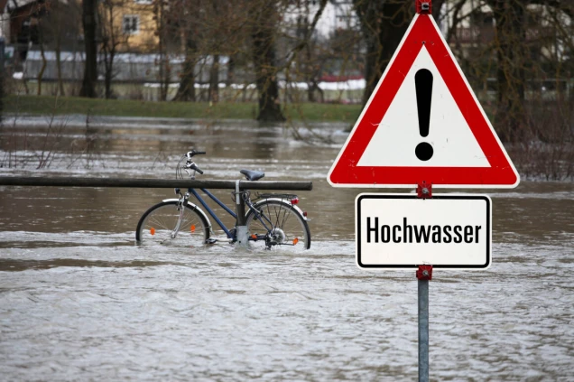
General Information
All citizens can use apps and websites to inform themselves about flood protection and better protect themselves and their homes.
-
Flood Portal NRW with current water levels and hydrological situation reports:
www.hochwasserportal.nrw.de -
Apps for iOS and Android: NINA, KATWARN, Meine Pegel
-
Web app for assessing risks for your own home:
hochwasser-app.nrw -
Information from the Federal Office of Civil Protection and Disaster Assistance:
Preparedness and Action during Floods
Area-Specific Information from Cooperation Partners
On the following pages, you will find information about the respective areas.
Flood formation
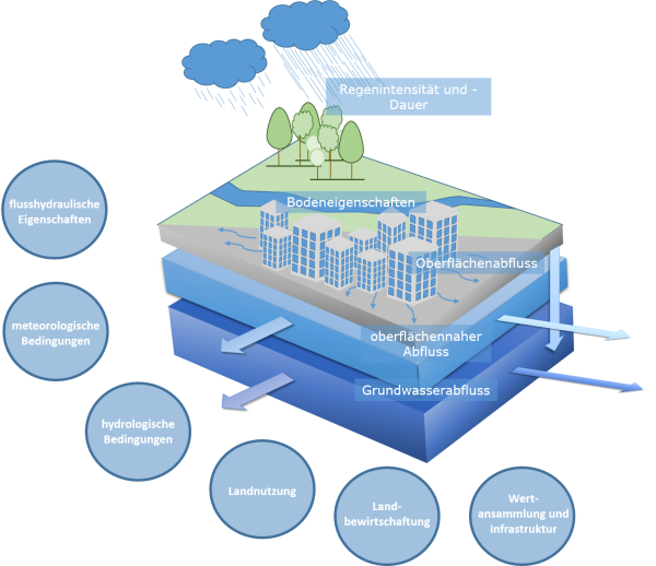
The main cause of flooding results on the one hand from prolonged, large-scale rainfall, and on the other hand from short-lived, locally confined heavy rain. The interplay of precipitation (intensity and amount) and soil properties (storage capacity, water saturation, infiltration rate) is central.
In the development of floods and flash floods, other important factors come into play, significantly increasing the complexity: river hydraulic properties, meteorological and hydrological conditions, land use and management, as well as riverside assets and properties.
Only the combination of these aspects leads to the emergence of damage risks from flooding events.
Precipitation is controlled by the water cycle. Climate change also affects the water cycle and consequently the occurrence of floods and heavy rain. When near-surface temperatures rise, the atmosphere's ability to absorb water vapor also increases. Based on this, it can be assumed that there is a trend toward an increase in the frequency and intensity of precipitation events.
Active action and advancing preventive protection against heavy rain and floods are therefore of great importance.
Cooperation Flood Prevention at Agger and Wupper
Floods and heavy rainfall know no administrative boundaries. They therefore pose a challenge that transcends district and city boundaries and make a holistic consideration of the issue all the more significant.
Against this background, the Ennepe-Ruhr district, the Oberbergischer district, the Rhein-Sieg district, the Rheinisch-Bergischer district, the cities of Leverkusen, Remscheid, Solingen, and Wuppertal, as well as the Agger and Wupper associations, joined forces in January 2023 to form the cooperation “Flood Prevention on the Agger and Wupper”.
The cooperation “Flood Prevention on the Agger and Wupper” aims to develop measures and solutions that serve proactive flood and heavy rainfall protection. In doing so, the cooperation partners intend to work together intermunicipally across their boundaries, pooling resources, sharing expertise, and leveraging synergies.
This creates and promotes further support for both citizens and the future-oriented planning processes of cities and municipalities to reduce risks. Thus, the various partners network with one another, and a holistic information management system is established.
The heavy and widespread rainfall in July 2021 and the resulting flooding events have surpassed all previous experiences in terms of their impacts. Forecasts and trend observations indicate that such events will occur more frequently in the future, making the necessity for action very evident.
It is therefore all the more important to make preparations in advance of such flooding events. Measures such as spatial planning for flood-prone areas, natural water retention in the context of regional and building planning, preparation for hazard mitigation and disaster management, as well as targeted behavioral and informational precautions, are part of effective preparedness.
In its 10-point action plan, the Ministry for the Environment of the state of North Rhine-Westphalia has outlined topics essential for successful adaptation to future climate change-related heavy rain and flood events. Among other things, these include flood information, forecasting, and reporting services, the collaboration between spatial planning, urban development, and water management, as well as strengthening self-help capabilities.
The cooperation “Flood Prevention at Agger and Wupper” builds on this. Its goal is to foster collaboration through targeted information and knowledge exchange in the areas of flood protection, heavy rain protection, and handling floods across various administrations.
For the Wupper, focal points (hotspots) in flood prevention are to be identified, and measures to reduce risks are to be planned and implemented.
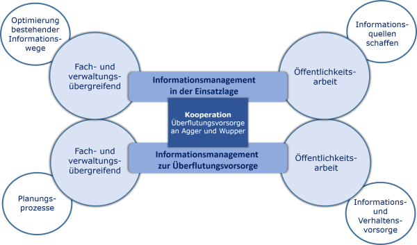
The illustration shows the central fields of activity of the cooperation. For networking all essential areas of action in flood and heavy rain risk management, good information management is needed, both in emergency situations and in prevention. An equally important component is the planning processes associated with flood prevention. In addition to inter-municipal, cross-disciplinary, and cross-administrative information management, communication with the population is a key element.
Steering Group
The project and the tasks of the cooperation are directed by the steering group.
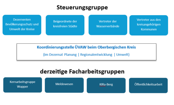
It is composed of the responsible department heads of the districts and independent cities or other equivalent function holders for the areas of environment and civil protection, as well as representatives of the two water associations. Additionally, delegates from the participating districts are also represented.
Coordination
Lena Prengemann, Oberbergischer Kreis
The coordination is based in the Oberbergischer Kreis.
Committees and Specialized Working Groups
To advance specific projects in the areas of preventive flood and heavy rain protection, as well as civil protection within the Agger and Wupper catchment areas, and to address the diversity and complexity of the tasks, specialized working groups are established for overarching topics. These groups focus on various specialized tasks. The results and progress achieved here are regularly reported to the steering group.
The specialized working group on reporting and the core working group Wupper can be mentioned as examples of these groups.
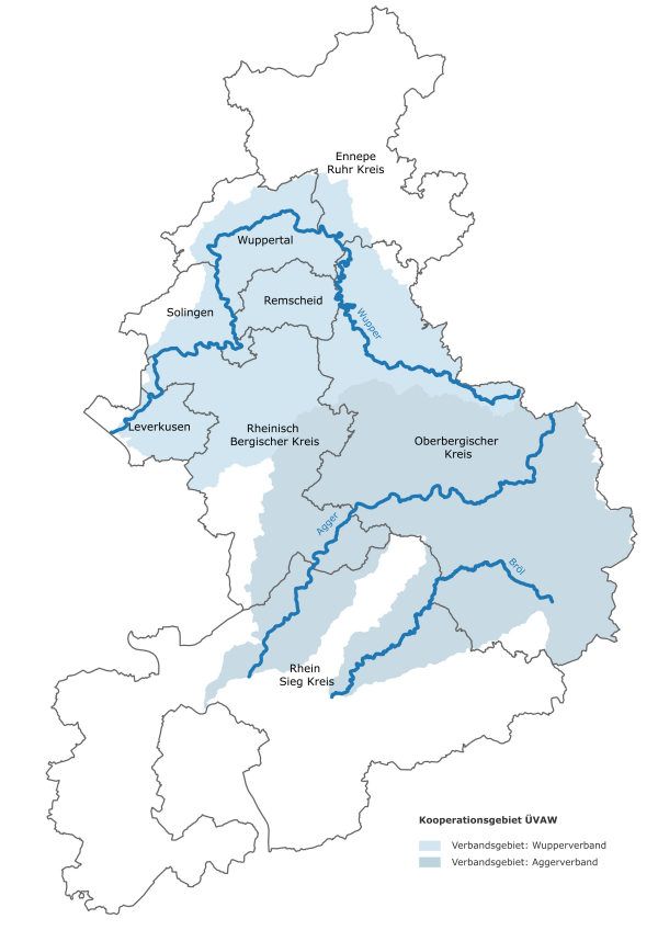
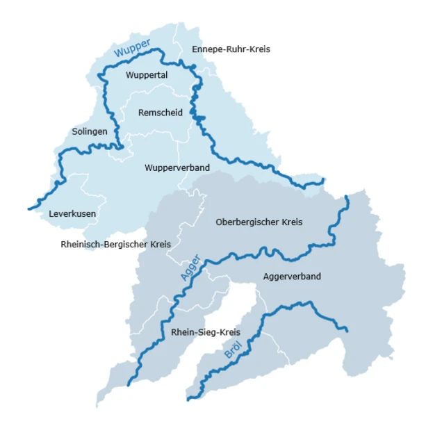
The cooperation area "Flood Prevention at Agger and Wupper" refers to the water systems of Agger and Wupper, as well as the Bröl, which, like the Agger course, flows into the Sieg.
An external communication committee has been established.
Spokesperson of the cooperation:
Frank Herhaus, Head of the Planning │ Regional Development │ Environment Department of the Oberbergischer Kreis.
Deputy Spokesperson of the cooperation:
Barbara Reul-Nocke, Deputy Mayor for Order, Security, and Law of the city of Remscheid.
Contact
Coordination of Flood Prevention at Agger and Wupper
Lena Prengemann
