 copyright: OBK
Landscape planning
This page was translated from German using artificial intelligence. The translation may contain errors or inaccuracies. In case of doubt, the German original version prevails.
Landscape Plan – Tasks and Objectives
The landscape is the foundation of life for humans, as well as for wild plants and animals. To avoid or mitigate negative impacts on the landscape and to ensure the preservation of our habitat in the long term, landscape plans are established. These plans provide binding regulations for the protection, maintenance, and development of the landscape for everyone. This includes the designation of protected areas and objects. The landscape plan outlines the maintenance and development measures to ensure a diverse species community and an improvement in the landscape's appearance.
When creating a landscape plan, which consists of a map and text section, existing plans such as state development and regional plans, land use plans, and zoning plans are taken into account.
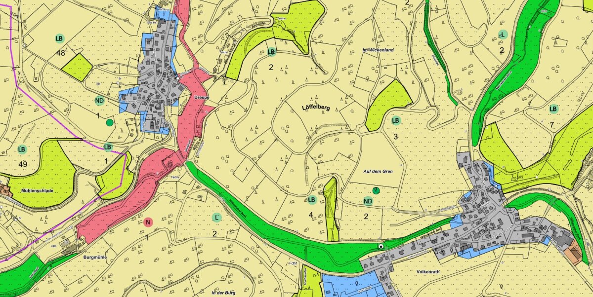
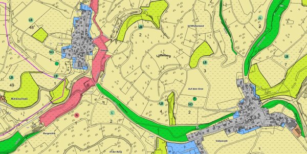
The development and regulation representations of the legally binding landscape plans of the Oberberg district can be found in the RIO Raum Information Oberberg at OBK RIO 4.2.4 - Climate, Nature, and Environment .
To draft a landscape plan, the natural and human living foundations such as soil, water, air/climate, animal and plant life, as well as the landscape image, are recorded and evaluated.
This is done through a comprehensive inventory that also considers the sensitivities of the landscape to disturbances.
By formulating a guiding principle, the desired state for the region is described. The difference between the current state and the guiding principle results in a catalog of measures, which is listed and described in the landscape plan as specific provisions.
Landscape planning is a mandatory task of the districts and independent cities in accordance with the Federal Nature Conservation Act and the Nature Conservation Act of North Rhine-Westphalia.
The determinations of the landscape plans and their spatial scope are legally binding for all citizens.
Between the resolution to draft and the enactment of a landscape plan, the public announcement, the hearing of those affected, the disclosure, and the review of concerns and suggestions must be adhered to during the process. As a result, the entire process can take several years.
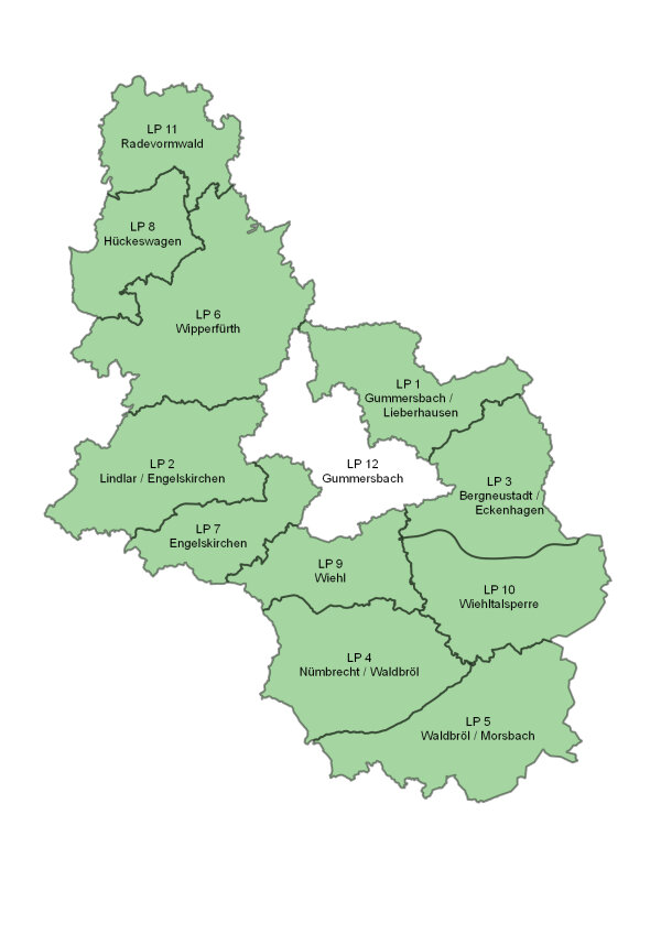
Landscape planning has been carried out in the Oberbergischer Kreis for more than 40 years. During this time, eleven of the twelve planned landscape plans have been finalized and partially subjected to several amendment processes. The individual plans do not always align precisely with municipal boundaries.
The legally binding landscape plans (LP) are:
-
LP 1 - Marienheide/Lieberhausen
-
LP 2 - Lindlar/Engelskirchen
-
LP 3 - Bergneustadt/Eckenhagen
-
LP 4 - Nümbrecht/Waldbröl
-
LP 5 - Waldbröl/Morsbach
-
LP 6 - Wipperfürth
-
LP 7 - Engelskirchen
-
LP 8 - Hückeswagen
-
LP 9 - Wiehl
-
LP 10 - Wiehltalsperre
The textual versions and development and determination maps of the individual landscape plans can be viewed in the Regional Information System Oberberg (RIO) - Planning, Building, Environment at https://rio.obk.de.
The remaining Landscape Plan No. 12 Gummersbach is currently being prepared.
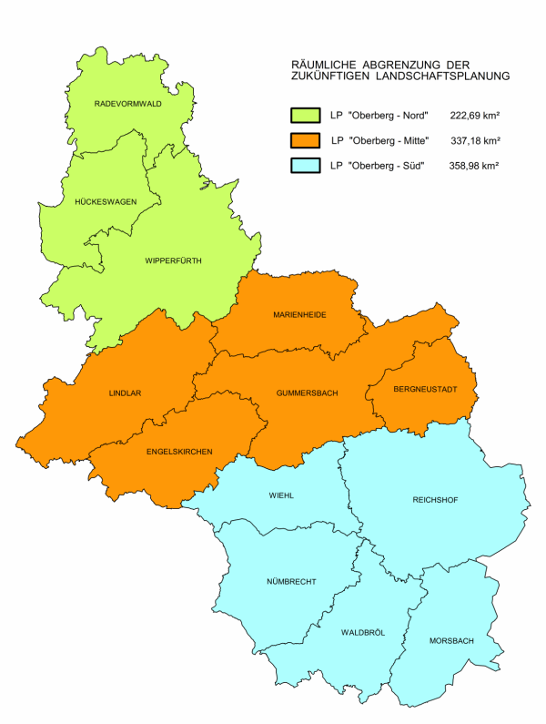
The update of landscape planning takes place in the following three new planning units instead of 12 individual landscape plans (LP):
- LP „Oberberg-North“ consisting of the subsections Radevormwald, Hückeswagen, and Wipperfürth (municipal boundaries).
It replaces the previous LP 6 (partially), LP 8, and LP 11. - LP „Oberberg-Central“ consisting of the subsections Marienheide, Lindlar, Engelskirchen, Gummersbach, and Bergneustadt.
It replaces the previous LP 1, LP 2, LP 3 (partially), LP 7, and LP 12. - LP „Oberberg-South“ consisting of the subsections Wiehl, Reichshof, Nümbrecht, Waldbröl, Morsbach.
It replaces the previous LP 3 (partially), LP 4, LP 5, LP 9, and LP 10.
- Preservation of a cultural landscape rich in or abundantly equipped with natural habitats or other natural landscape elements.
- Optimization of a landscape worth preserving as a whole, with natural habitats, through structuring and enlivening landscape elements.
- Restoration of a landscape damaged or severely neglected in its functional interrelation, appearance, or surface structure.
- Development of the landscape for recreation
- Equipping the landscape for purposes of emission control or climate improvement
- Restoration of the capacity of the natural ecosystem and landscape-appropriate design of the landscape's appearance during interventions in nature and landscape
- Preservation of the landscape until construction use, i.e., areas outside the developed local parts already depicted as building areas in the land use plan and areas depicted as residential, commercial, or industrial settlement areas in the regional development plan.
- Preservation of geomorphologically distinctive landscape parts
- Preservation and development of areas for purposes of local recreation, vacation recreation, and other leisure activities within a landscape worth preserving as a whole
- Preservation of the landscape structure secured by the landscape plan in the settlement areas depicted in the regional plan
- Improvement of the quality of life in villages and hamlets
- Preservation of unfragmented, low-traffic landscape areas
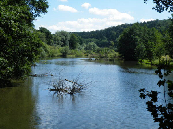
In the landscape plan, protected areas and objects are established with a catalog of rules and prohibitions:
- In nature conservation areas (NCAs), all actions that could negatively impact the area and its animal and plant life must be avoided.
- In landscape conservation areas (LCAs), all actions threatening the character and conservation purpose of the area must be avoided.
As specific and small-scale objects, natural monuments (NM) and protected landscape components (PLC) are established in the landscape plan with the necessary rules and prohibitions.
Concrete individual projects serve to achieve the objectives of the landscape plan and the protection purpose of the individual objects to be protected:
- Creation, restoration, or maintenance of near-natural habitats
- Creation, maintenance, or planting of diverse types of woody plants
- The restoration of damaged properties
- Maintenance measures to preserve or restore the landscape image by removing sealed surfaces and restoring valley and hillside meadows as well as grassland areas
In the intensively used landscape, areas left to natural development or managed extensively serve as valuable habitats for animals and plants.
In close collaboration with the Regional Forestry Office Bergisches Land, the use or exclusion of certain tree species is determined during initial and reforestation in nature reserves.
Furthermore, clear-cutting as the final utilization is prohibited in certain forest areas.
Since 1996, the Biological Station Oberberg e. V. (BSO) has been implementing the requirements set in the landscape plan. The Oberberg district and the BSO strive to reach an agreement with the owners and managers of the affected areas regarding the use of the land.
Contact
Frederic Theis
Rahul Klein
